I’m continuing to work on a 3D reconstruction of ancient Rome and returning to regularly releasing videos on YouTube and posting regularly here on the website.
The pause in activity here was due to my previous email service, Mailchimp, changing its terms of service, shutting down its database, and demanding money. Now that those issues have been resolved, I’ve switched to Sender, which is more responsive.
I plan for the website to be one of my main platforms, where I can fully share my content without being constrained by social media bias. Posts will include both news (new videos, reconstruction progress, etc.) and more in-depth content on various interesting topics in Roman history and archaeology.
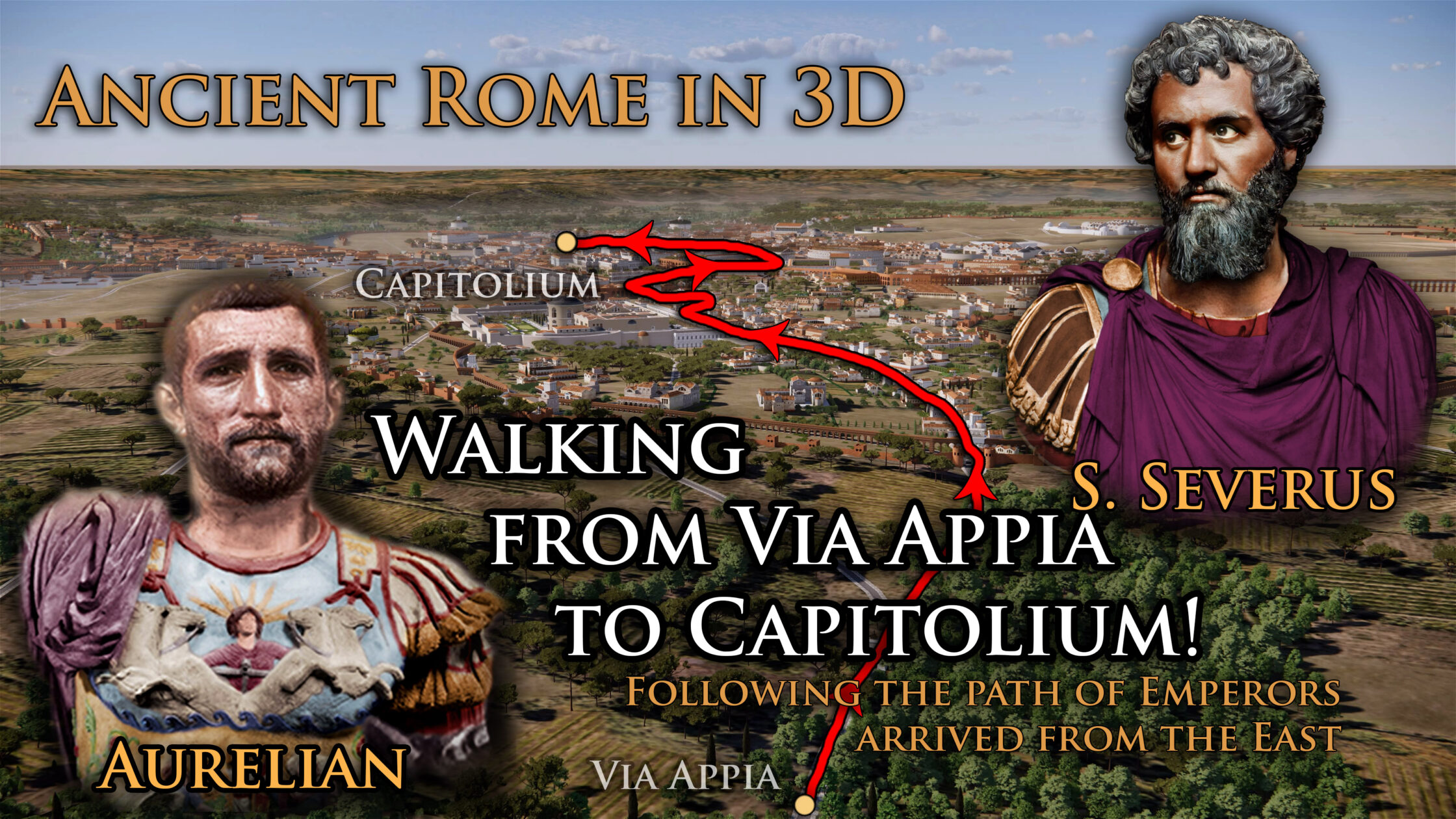
In December, I’m releasing a series of “walking tours” through Rome on YouTube, which have proven popular with viewers. Today, Part 3 was released – a route from the Sacred Grove of Mars (1), on the Via Appia outside the City walls, all the way to the Capitoline Hill (13)! This route was used by those arriving from the East, disembarking at the port of Brundisium and arriving via the Appian Way through Capua. For example, it was likely along this route that the emperors Septimius Severus and Aurelian made their ceremonial entry (‘adventus‘) after their victorious campaigns in Parthia and Syria.
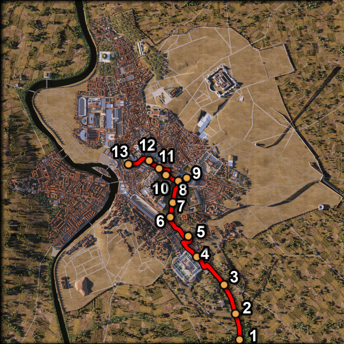
In this video, we’ll see Rome as it was in the 4th century CE and visit many famous locations, such as the Porta Appia (2), the Tomb of the Scipios (3), the Baths of Caracalla (4), the Mutatorium (5), the Septizodium (6), the Aqua Claudia (7), the Meta Sudans (8), the Colosseum (9), the Arch of Titus (10), the Via Sacra (11), the Forum Romanum (12), and finally, the Capitoline Hill itself with the Temple of Jupiter (13). Enjoy!
Let’s take a closer look at some of the places shown in this video between Porta Appia and the center of Rome.
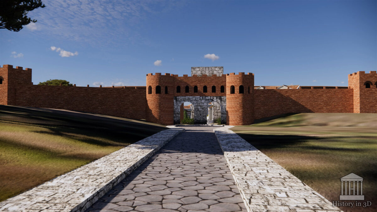
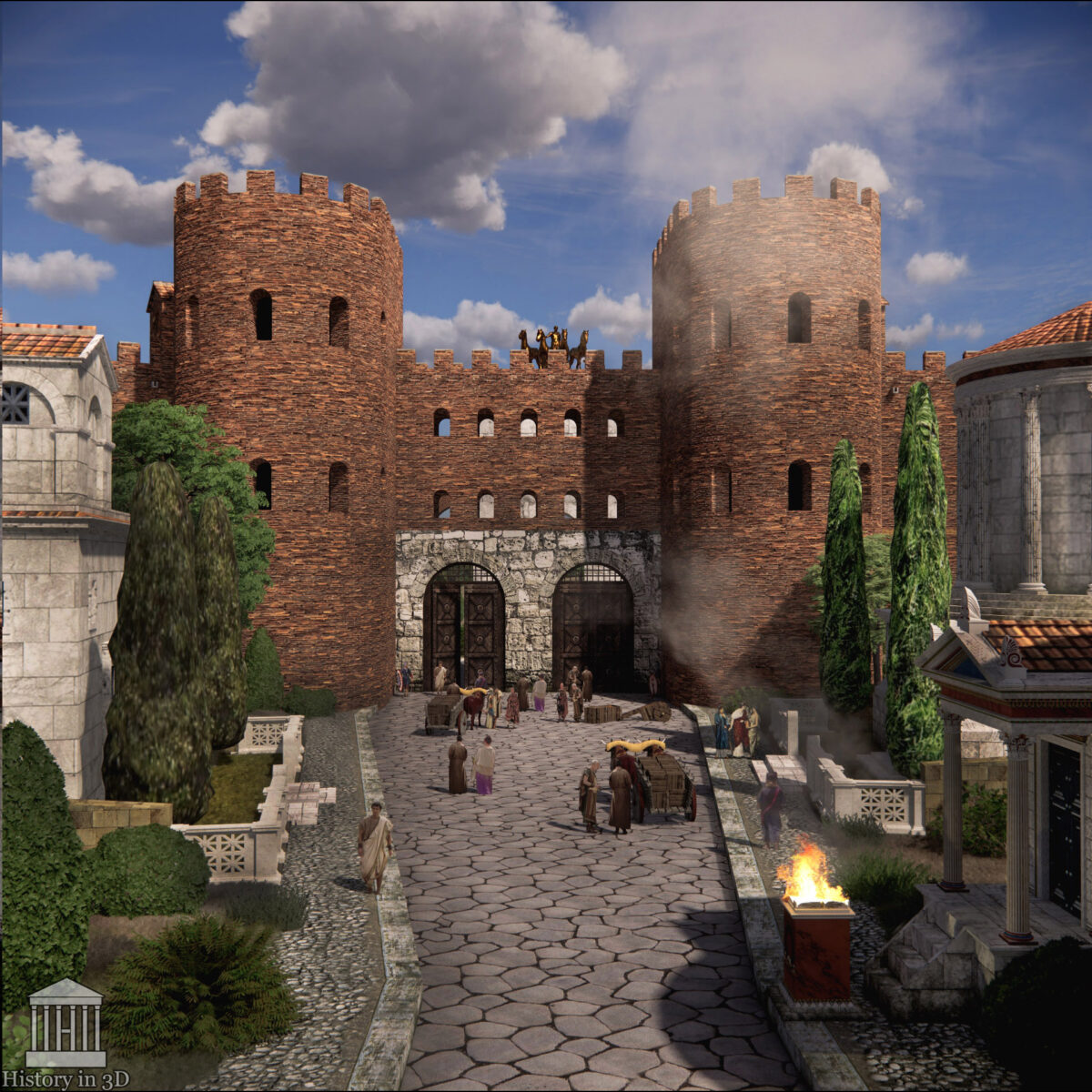
PORTA APPIA (2 on map)
This was one of the most important and largest gates in Rome, standing on the Appian Way. The gate was extensively rebuilt several times, including during the ancient era. Today, it is known as Porta San Sebastiano.
The video shows the very first version of the gate, shortly after the construction of the walls under Aurelian and Probus. However, in the future, I will replace it with a more accurate reconstruction for the 4th century.
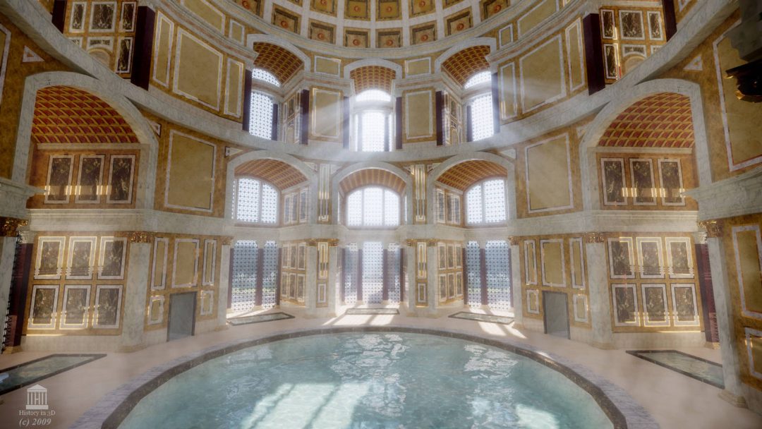
The new version is already ready, but is located in a separate file. This is what the Porta Appia will look like when I add it to the overall 3D reconstruction of Rome:
TOMB OF THE SCIPIOS (3 on map)
The famous burial site of one of Rome’s most illustrious and distinguished families. The entire Via Appia, from the old Porta Capena, was lined with family tombs and columbaria. Over the centuries, the Сity expanded, and residential buildings, including multi-family insulae, were incorporated into this structure. One of these was also attached to the Scipio Tomb.
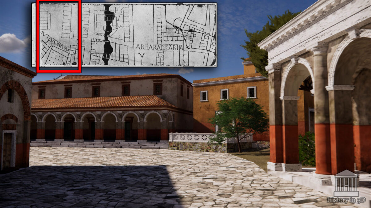
MUTATORIUM (5 on map)
The site, whose location and layout are reconstructed with remarkable precision from the Forma Urbis (Marble Plan of Rome), is clearly visible on the best-preserved (almost complete) slab of the plan. Apparently, this was the site of a complex of utility and infrastructure buildings, where, among other things, transport used outside Rome was replaced by transport permitted within the City limits. As is well known, within Rome, there were restrictions on carts, chariots, horseback riding, and other means of transportation.
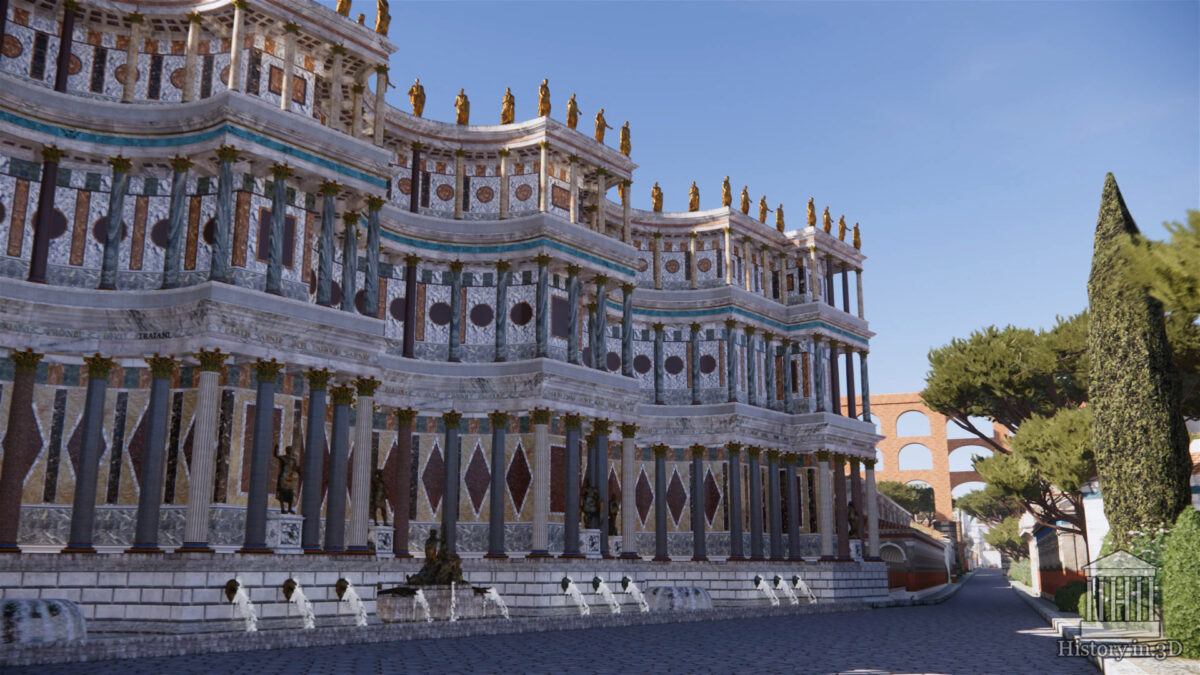
SEPTIZODIUM (6 on map)
Rome boasted numerous nymphaeums — ornate, decorative fountains and pools that also had a sacred component, as reflected in their name (sanctuary of the nymphs). Over time, these impressive structures also assumed an increasingly significant utilitarian and practical significance. The Septizodium was built in the early 3rd century under Emperor Septimius Severus, during a major reconstruction of this part of the Сity.
It is believed that this colossal and richly decorated colonnade with fountains served several important functions. In addition to serving as a source of water, the Septizodium was intended to make a lasting impression on visitors arriving in Rome via the Appian Way. Furthermore, the nymphaeum’s high and wide façade concealed numerous outbuildings and retaining walls of the annexes to the imperial palaces on the Palatine Hill.
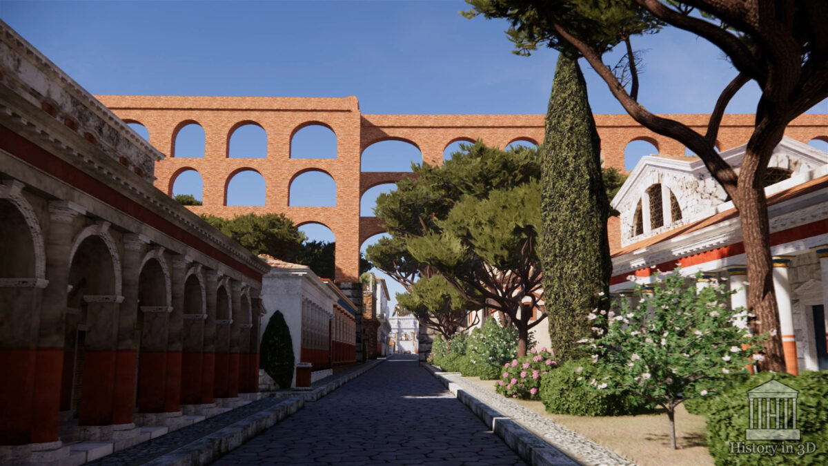
AQUA CLAUDIA (7 on map)
Rome was fed by numerous aqueducts, which ensured a constant and abundant supply of water for centuries. Under Emperor Claudius, one of the largest, the Aqua Claudia, was built. It was completed under Nero and other subsequent emperors, and was eventually extended to the Palatine, where it supplied the vast complex of imperial palaces.
The impressive ruins of this aqueduct can be seen along its entire route, from today’s Porta Maggiore, across the Caelian Hill, and up to the Palatine Hill. It was raised to an impressive height, and the arcades were stacked one on top of the other, so that, as ancient authors put it, even at the top of the hill, it cascaded like a waterfall!